
From reactive maintenance cycles of 18 months to proactive planning over 20 years
SkyGeo measures the soil subsidence of every road in the city of Diemen with millimeter precision. Maintenance planners receive subsidence figures for all neighborhoods, based on satellite images since 1992. For the first time, maintenance planning for roads and sewers is based on a complete set of quantitative data. This data offers new insights. As a result, the city can save €200,000 annually on maintenance costs.
“Problems we had for years with manual measurements were solved in one fell swoop.”
Ron Kaptijn, Infrastructure Policy Officer, Municipality of Diemen
Preventing damage due to relocation
The municipality of Diemen is built on very soft soil. Due to the decomposition of peat, rapid ground subsidence of up to 50 centimeters occurs over a period of 20 years. Differences in soil composition cause the rate of subsidence to vary significantly between neighborhoods and even within streets. Maintenance is necessary when the subsidence exceeds 20 centimeters, the diameter of sewer pipes, at which point water can no longer drain away.
To prevent disruptions, the municipality must periodically reconstruct and raise roads and drainage systems in each neighborhood.

Ground subsidence in the city of Diemen leads to many inconveniences, but also to dangerous situations, such as burst gas pipes.
Scheduling maintenance cycles
The municipality has an annual budget of €2.2 million for the maintenance of roads and sewers for its 20,000 inhabitants. Until now, the degree of subsidence was measured by visual inspection, which is neither accurate, nor repeatable, nor geographically complete.
Differences in subsidence percentages are difficult to quantify in this way, causing maintenance to take place either unnecessarily early or too late.

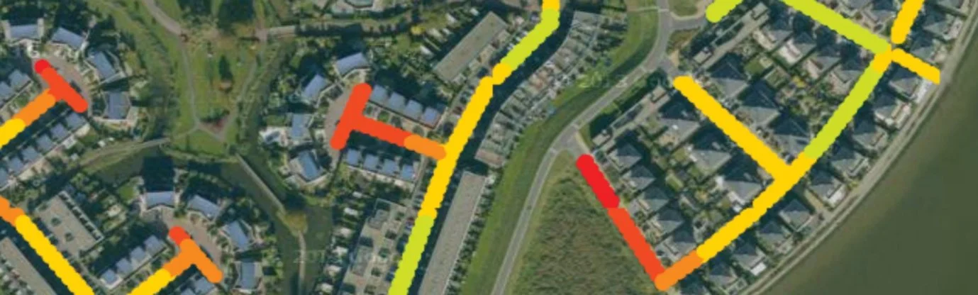
Soil subsidence map of Diemen. The degree of subsidence varies significantly from street to street.
Accurately mapping movements
SkyGeo uses radar images captured by satellites since 1992 to determine ground subsidence in millimeters for thousands of locations in the municipality. Based on the resulting map, the city calculates the average time between road and sewer maintenance by extrapolating the long-term results to the next 20 years.
Efficient maintenance plans
Subsequently, the ground subsidence map enables the city to accurately calculate maintenance cycles at every level (buildings, streets, neighborhoods). The map shows the dynamics of ground subsidence, allowing the city to better prevent potential sewer emergencies.

Aggregation of displacement data from the image above. The 20th percentile points have been converted into a map indicating the average time to failure in years.
Better allocation of expenses
The soil subsidence map also suggested that maintenance can be safely postponed in many neighborhoods. This leads to significant savings on annual maintenance costs and a reduction in the impact of construction work in the neighborhood.

Differences in settlements in a sewer system due to projection of displacement data onto the pipes.
The greater profit
Diemen proved that maintenance is no longer a gamble when applying InSAR assessments. Thanks to a city-wide, millimeter-precise overview of soil subsidence dating back to 1992, planners can now predict 20-year maintenance horizons instead of having to react every 18 months.
The result is not only cleaner data, but also annual savings of €200,000 and reduced emergency excavation work, ensuring continuity of service in a city with soft soil where peat can lead to subsidence of up to 50 cm over twenty years. It is a scalable model for any city with tight budgets, outdated utilities, and fluctuating soil conditions.
Are you ready to use time to your advantage? SkyGeo is ready to help you, or any other location . Contact our team today.
