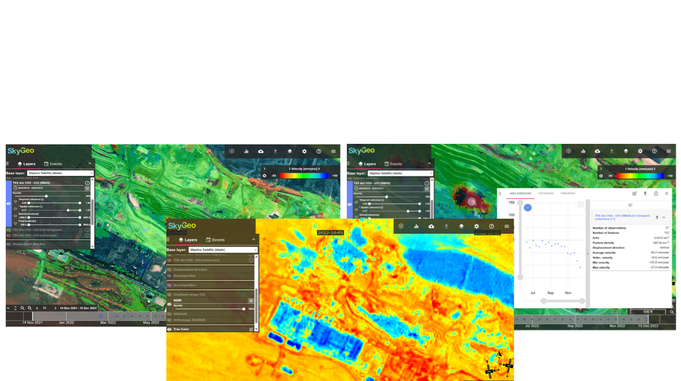
SkyGeo InSAR Data Viewer
Interrogating InSAR data for multidisciplinary teams.
Control, query and export
We built our own GIS-like tools for users that need to understand the large multi-dimensional InSAR data.
Essential dynamics
Built to support hundreds of clicks by power users. Query time series in very large InSAR data sets to quantify patterns.
Flexible visualization
Set user groups and configure what they see. Without a viewer, the InSAR data quickly loses a lot of its poer to inform.
Export only what you need
Export the data you need without breaking your GIS. See the surface move - and do inversion to show sub-surface dynamics.
TOP TEAMS SUCCEED WITH SKYGEO