POTASH MINING COMPANY CASE STUDY
IDENTIFYING INSTABILITIES WITH InSARPOTASH MINING COMPANY PREVENTS DAMAGE TO DIKES WITH SKYGEO’S PROPRIETARY APPROACH TO DISCOVERING GEOTECHNICAL RISK
SkyGeo provides dike safety engineer new insights in dike stability with 1000x more data than conventional leveling. Deployed in the right context, this wealth of data brings a step change to improved management of compound geotechnical risk.
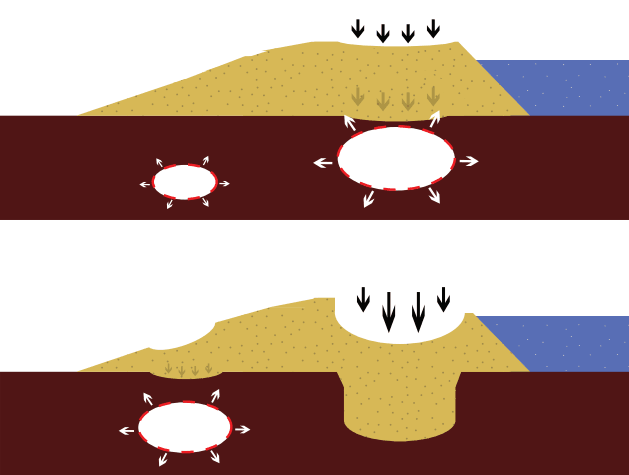
Sinkholes, a looming disaster.
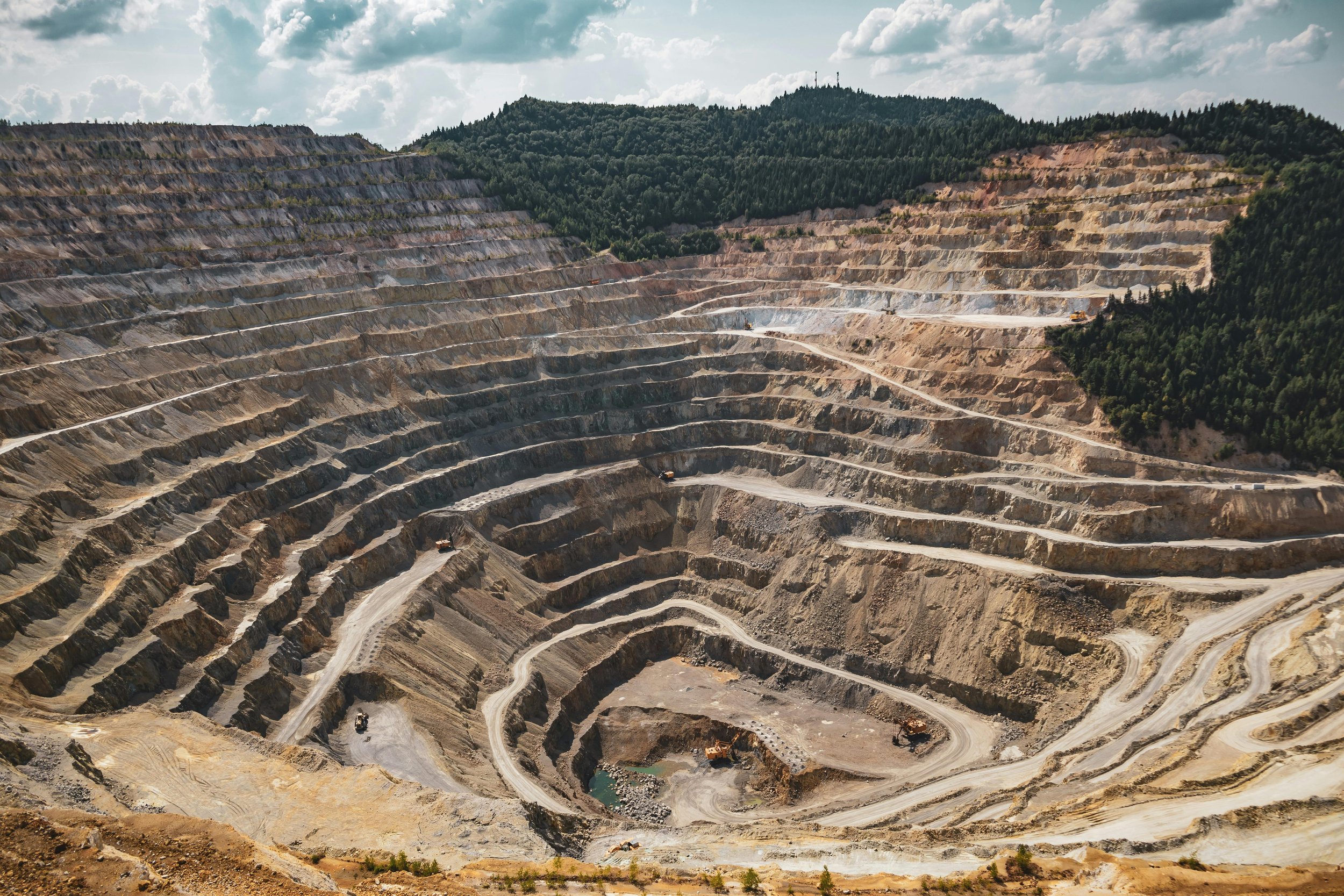
In the vicinity of the Dead Sea, a client operates salt ponds surrounded by a system of dikes. A progressive salt karst system is associated with the sudden occurrence of sinkholes. One of these unnoticed sinkholes created a large breach in a dike, draining the entire basin and causing $38M in damages.
Leveraging SkyGeo’s holistic approach to managing geotechnical risk, the client now identifies sinkholes as early as possible and minimizes the probability of a catastrophic collapse causing dike failure.
Traditional leveling method falls short.
Previously, the client used a siloed data approach to height change detection using Lidar + leveling campaigns every 6 months with monuments installed every 500m and in high suspect zones every 200m.
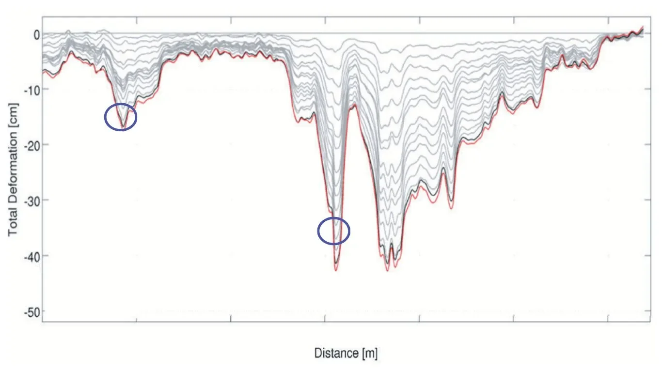
That approach proved insufficient, as the whole region sinks rapidly, frequently and unevenly. Sinkhole precursors present themselves at the surface of the dikes as local round subsidence troughs, with diameters of 10’s of meters and depths up to a few centimeters superposed on the uneven regional subsidence pattern. Cracks and slides are also widespread, which makes detection difficult so sinkholes in between stations are easily overlooked.
Much more data, better analytics, clearer risk assessment.
By incorporating multiple data inputs into our analysis, including Lidar, InSAR, client observation and experience, and our proprietary analytics, we provided the dike safety manager more data on these round deformation patterns, over a larger area with potential for more frequent updates updates. Assessment of sinkhole formation is now done with much higher confidence than previously attainable using a single, siloed, end-point solution ground movement analytics.
High accuracy risk identification with SkyGeo.
With over 50,000 measurements per km2 on and around the dike, there are no gaps larger than a sinkhole diameter in between our measurement points. The regional subsidence rates vary between 0-30 cm per year. To visualize precursors on the crest of the dike, time series are aggregated over cells 100m across, and 20m along the dike.
Regional context necessary to understand failure modes.
Since deformation measurements are constantly updated, growth patterns and acceleration over time of subsidence deviations become visible. Only by characterizing the deformation dynamics and translating that to regional geology and active faults, local sinkhole patterns can be isolated and understood.
Data analytics in context of risk.
Since the mining company started using SkyGeo’s approach to measuring geotechnical risk, it has avoided sinkhole damage to their dikes altogether. In one case a likely precursor turned out to form a sinkhole near the foreshore about a year after identification. Sinkhole Scanner remains in use to observe the dikes. If and where a high-risk precursor pattern shows up, geophysical assessment can be done.
This is in-situ electrical resistivity assessment with a high cost per m2 , and it is now only deployed as a targeted local investigation. Then, where needed, preventive maintenance can be initiated on the sinkholes.
Compound risk.
The system of dikes is subject to a variety of failure modes aside from sinkholes. Active regional tectonics, salt diapirism, and constructions built on low shear strength clays are all sources of complex risk. Moreover, to the operator of the basins these factors present compound risk.
Not drowning in data.
The enormous increase in data poses a new potential problem for the users. InSAR data on their own just tells you that everything is moving: background and dikes alike. So you need to look at this tsunami of data in the right context.
This is exactly what the SkyGeo platform does: for the SkyGeo engineers make sure in an iterative way that we have the right InSAR data; then we help users assess the data of deformation dynamics in the context of their geology and engineering. By benchmarking, we separate the signal that constitutes risk from the noise of deformation dynamics that does not constitute risk.
Discovery of additional failure modes
As Geotechnical Engineering has started to trust the SkyGeo data approach, this project has evolved. We improved to assess more of the dikes in the region, and then we progressively supported forensics of additional failure modes. SkyGeo has become a trusted partner for risk evaluation.
Traditional surveying remains in place, serving as the reference points in the SkyGeo holistic approach to evaluate compound geotechnical risk.
Let´s prevent any possible damage to your assets, together. Talk to our Expert team.