
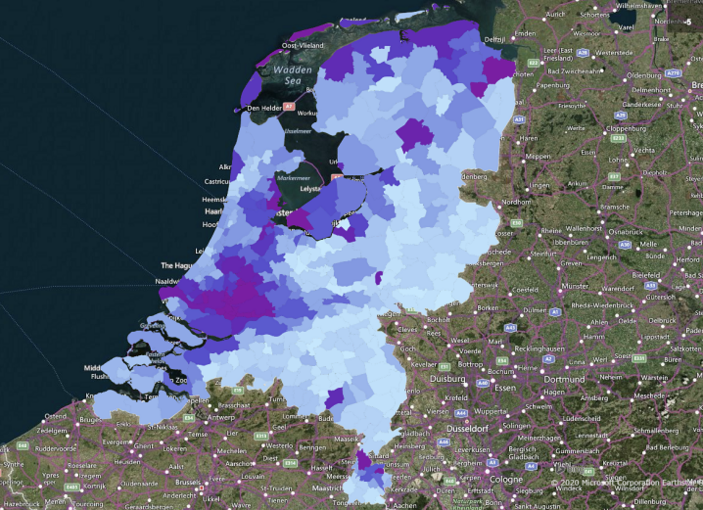
New Reference Map for the Whole of the Netherlands.
Leaning houses, sinking streets, shifting dikes, and drying up nature reserves. The Netherlands lies in a river delta and is therefore severely affected by current fluctuations in temperature and water level. The new interactive land subsidence map 2.0 provides insight into how the Netherlands is subsiding, with unprecedented millimeter-level detail for more than 40 billion measurements taken over the past four years.
The Netherlands is an international leader in the technology for measuring ground movement and its effects on buildings and infrastructure using satellites. Delft-based SkyGeo has been developing this technology for over 10 years and has clients worldwide. With the rollout of bodemdalingskaart.nl, in collaboration with NCG and Delft University of Technology, up-to-date information on ground movement is being made available to a wide audience. SkyGeo aims to demonstrate the technology's power and stimulate the development of new applications.
Pieter Bas Leezenberg, CEO of SkyGeo: “By making the Land Subsidence Map 2.0 publicly available, we are giving a huge boost to the use of InSAR as a standard methodology for measuring ground movement and its consequences. In October 2018, we launched the Land Subsidence Map 1.0 as a 2x2 kilometer reference map for the Netherlands – since then, more than 150,000 visitors have consulted this online map. With the publication of the Land Subsidence Map 2.0, everyone can experience our InSAR technology.”
National Reference Map
However, data processing isn't a simple matter of simply pushing a button. SkyGeo uses various methods, optimized for the application. "Publishing this generic map might give the impression that the satellite data can only be processed in one way," says Leezenberg. "This isn't the case: depending on the application, we can, for example, also show measurements that have now been discarded, or we can eliminate less suitable measurements."
Leezenberg isn't worried that this will come at the expense of SkyGeo's market. "Given the level of infrastructure investment, it would be illogical to only collect 'free' data from the internet for this purpose. You want to involve well-trained experts." Anyone can now use the generic data to explore and compare the effects of subsidence. After familiarizing themselves with this data, professional users can decide where and how further specialized InSAR research is needed.
Use Soil Subsidence Map
SkyGeo has been innovating for years to help infrastructure managers: primarily by producing increasingly better InSAR data to measure the impact of local events on subsidence and developing technology to recognize subsidence patterns. The quality of the satellite images supplied is also systematically improving. By releasing the detail level of bodemdalingskaart.nl, knowledge of and confidence in InSAR as a measurement tool will increase.
The dataset is being released so that business users can identify new subsidence patterns themselves. To increase their basic knowledge of InSAR, interested professionals can register free of charge for knowledge sessions and webinars on measuring subsidence. The reference map can be used via the soil subsidence map website, in the SkyGeo viewer, and downloaded as a map layer from there.